


Voting District 0818192000002, Kent County, Michigan
About
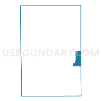
Outline

Summary
| Unique Area Identifier | 597391 |
| Name | Voting District 0818192000002 |
| County | Kent County |
| State | Michigan |
| Area (square miles) | 12.94 |
| Land Area (square miles) | 12.48 |
| Water Area (square miles) | 0.46 |
| % of Land Area | 96.46 |
| % of Water Area | 3.54 |
| Latitude of the Internal Point | 42.98473020 |
| Longtitude of the Internal Point | -85.33340410 |
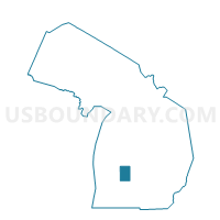
Maps

Graphs
Select a template below for downloading or customizing gragh for Voting District 0818192000002, Kent County, Michigan


Neighbors
Neighoring Voting District (by Name) Neighboring Voting District on the Map
- Voting District 0670968000003, Ionia County, MI
- Voting District 0674252000001, Ionia County, MI
- Voting District 0676158000001, Ionia County, MI
- Voting District 0813456000002, Kent County, MI
- Voting District 0814954000001, Kent County, MI
- Voting District 0814954000002, Kent County, MI
- Voting District 0814956000001, Kent County, MI
- Voting District 0814956000002, Kent County, MI
- Voting District 0818192000001, Kent County, MI
Top 10 Neighboring County Subdivision (by Population) Neighboring County Subdivision on the Map
- Lowell charter township, Kent County, MI (5,949)
- Boston township, Ionia County, MI (5,709)
- Vergennes township, Kent County, MI (4,189)
- Lowell city, Kent County, MI (3,783)
- Grattan township, Kent County, MI (3,621)
- Otisco township, Ionia County, MI (2,282)
- Keene township, Ionia County, MI (1,831)
Top 10 Neighboring Place (by Population) Neighboring Place on the Map
Top 10 Neighboring Unified School District (by Population) Neighboring Unified School District on the Map
Top 10 Neighboring State Legislative District Lower Chamber (by Population) Neighboring State Legislative District Lower Chamber on the Map
- State House District 86, MI (99,294)
- State House District 87, MI (96,428)
- State House District 70, MI (89,992)
Top 10 Neighboring State Legislative District Upper Chamber (by Population) Neighboring State Legislative District Upper Chamber on the Map
Top 10 Neighboring 111th Congressional District (by Population) Neighboring 111th Congressional District on the Map
Top 10 Neighboring Census Tract (by Population) Neighboring Census Tract on the Map
- Census Tract 313, Ionia County, MI (8,098)
- Census Tract 304, Ionia County, MI (6,846)
- Census Tract 120.03, Kent County, MI (6,342)
- Census Tract 120.04, Kent County, MI (4,563)
- Census Tract 109.02, Kent County, MI (3,669)